Listen up: Limited time offer on noise monitoring equipment
According to estimates from the Health and Safety Executive (HSE), 21,000 workers suffered with work related hearing problems between 2017 and 2019, with industrial...
Geo-data specialist supports entire English coastal monitoring network
The recent award of a three-year maintenance contract for the hydrodynamic element of the Anglian Coastal Monitoring programme means that geo-data specialist Fugro now...
Peak District National Park commissions ultra-high resolution aerial maps
The Peak District National Park Authority has commissioned a brand new ultra-high resolution aerial survey from aerial mapping firm Bluesky to map land cover...
Weather monitoring in extreme conditions
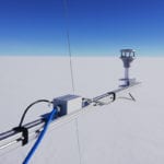
A VENTUS X ultrasonic wind sensor has been deployed by researchers at the Summit Station on the Greenland Ice Sheet in the Arctic, 10,000...
Gas sensor technology heads to Mars on board NASA’s Perseverance rover
An international collaboration is taking technology from gas measurement expert Vaisala and the Finnish Meteorological Institute (FMI) to Mars onboard NASA’s Mars 2020 Perseverance...
Taking the guesswork out of flood prediction
Sustainability software and data firm Ecometrica is aiming to take some of the guesswork out of flood and crop yield prediction, forest protection and...
Fish eDNA project launched at offshore wind farm
In a bid to validate offshore fish environmental DNA (eDNA) survey methods, a new project has been launched - said to be the first...
All-in-one noise monitoring station suitable for construction sites
Svantek, a manufacturer of noise and vibration instrumentation for occupational health and environmental monitoring applications, has launched the SV 200A all in one noise...
Vision system for biomass boilers becomes available in the UK
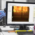
Bio-waste handling and processing firm Tidy Planet is bringing to the UK market an Artificial Vision System (AVS) for boilers - described as "the...
“No-code” solution will revolutionise access to satellite data, says firm
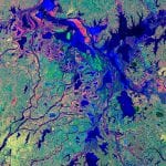
Edinburgh-based tech firm Earth Blox says it has demonstrated its ability to provide near-instantaneous cloud powered access and analysis of satellite imagery in a...
Doppler resonance LIDAR promises advances in sensitivity and real-time performance for atmospheric research
Sensitive enough to detect laser beam reflections from single atoms 100 km away even in broad daylight
Atmospheric research uses pulsed laser beams to measure...
Landmark flight time recorded for hydrogen-powered UAV
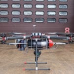
A project to develop a hydrogen fuel cell powered multi-rotor unmanned aerial vehicle (UAV), has beaten its original test flight target of 60 minutes...
Emissions analyser helps manage power station
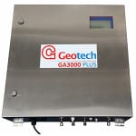
A multiparameter emissions monitor at Thetford power station is being used to demonstrate to the Environment Agency that the plant is performing within the...
Aerial mapping firm launches tree failure risk tool
In partnership with the University of Lancaster, aerial mapping company Bluesky has launched a new tool which can be used to predict the likelihood...
Do you have a contingency plan if your fixed gas analyser needs maintenance?
Your plant technicians rigorously check for contaminates within your digester and ensure that performance is optimised but has your business considered the upkeep of...
Conference presentations point to LiDAR’s growing preeminence in offshore wind measurement
Wind measurement experts gathered in London in June concluded that LiDAR technology had over the years fully proven its ability to provide wind measurements...
Portable PID helps geotechnical firm stay on track
AWARD-winning geotechnical company BAMRitchies Limited is using an Ion Science handheld Tiger photoionisation detector (PID) for nightly monitoring of volatile organic compound (VOCs) concentrations...
Thunderstorm detector proves its mettle at Eindhoven air base
Meteorological specialist Biral has had its BTD-300 Thunderstorm Detector installed at Eindhoven Air Base in the Netherlands.
Eindhoven Air Base is the home base of...
Drones produce high-res aerial photos for SLR
(Above) RPAS's provide high resolution aerial photos and maps. (Below) Higher resolution image of the same site.
SLR Consulting Ireland is helping clients to...
Study looks for lithium ‘fingerprint’ from space
A team of data scientists at the Satellite Applications Catapult is leading a new study, funded by Innovate UK, to see if it is possible to detect a lithium ‘fingerprint’ from space


